|
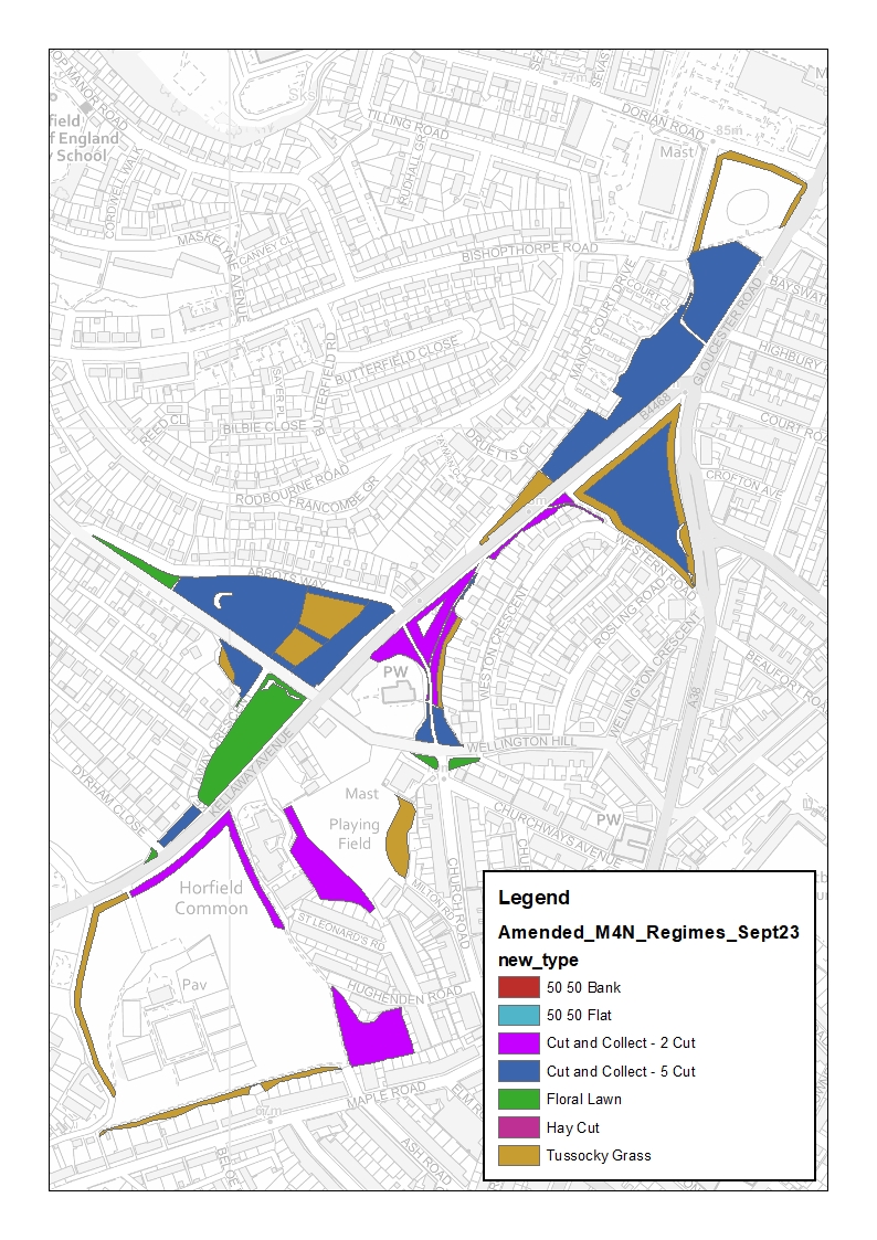
FOHC is working with the Council to refresh the cutting map and we need your views! What is a cutting map? This shows where and how often the grass is cut in the area. For example, short grass for playing fields will be cut more often: "5 cut" means it will be cut 5 times a year. Why do we need to refresh it? The last refresh was in 2015! We would like to provide a better environment for wildlife/plantlife across the Common. This summer, as we maintained the meadow patches and set up protections for the cat-mint, we realised that the old map is hard to follow and can easily lead to missed cuttings/miscommunication as well. How can I help? An initial map has now been completed and we will be meeting with the Council on the 18th December to feed back. Please note that this is a proposed map and implementation will depend on a number of factors as we move through the process. Please see the key and map image (also provided as downloads for easier reading) and send us your initial thoughts by the 17th December! Email them to [email protected].  Key: The management descriptions of the different regimes are as follows: Floral Lawn
Cut and Collect – 2-cuts
Cut and Collect – 5-cuts
Tussocky Grass
Bank 50/50
The maps also show some areas identified as ‘Flat 50/50’. These are areas that would be split between the ‘Cut and collect – 2-cut’ regime and the ‘Tussocky Grass’ regimes as described above.
0 Comments
Your comment will be posted after it is approved.
Leave a Reply. |
|||||
 RSS Feed
